

Move! Bike Computer

คำอธิบายของMove! Bike Computer
The Move! Bike Computer is advanced GPS track logger and speedometer.
You can use it for every activity and sport where speed and distance matters, like bike and bicycle riding, car driving. Run, walk, drive, sail with your phone, display any data you need on configurable main screen, or just save your trip's track to analyze them later on Google Maps, export routes to Google Earth, share with email, DropBox, or any other file sharing application to save your training for later analysis. Switch units between miles, kilometers, knots. Get your actual or average speed, check your altitude, compass bearing. All with your GPS enabled phone. If you are a pro user, just dump your trips data with raw format and use it as you want, or just export to Google's KML, or Garmin's GPX format to upload it to web site of your choice. You can also just keep your data on your phone or PC.
Features:
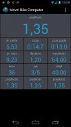
10 concurrent, configurable gauges.
Miles, Kilometers and Knots.
Current speed based on GPS receiver.
Pace (minutes per mile/km).
Maximum speed.
Average speed (with or without idle time).
Total trip time.
Active trip time.
Idle time.
Altitude (GPS or GPS + barometric sensor if available).
Total uphills.
Total downhills.
Bearing (GPS based).
Position error.
Visible / fixed satellites.
And 20 others
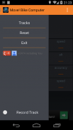
Track recording (works in background).
Export track to KML, GPX or CSV. Save it to your SD card or email. Or just put it on your Google Drive and share your with friends.
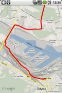
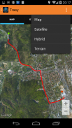
View track on a map, just in application or use your favorite software.
Track statistics - view or share by any of your messaging apps.
Extensive customization options.
Raw data dump in CSV format with GPS position, speed, bearing, altitude and time.
ย้าย! คอมพิวเตอร์จักรยานเป็นขั้นสูงคนตัดไม้ติดตาม GPS และหน้าปัด
คุณสามารถใช้มันสำหรับทุกกิจกรรมและกีฬาเรื่องที่ความเร็วและระยะทางเช่นจักรยานและขี่จักรยานขับรถ เรียกใช้เดินไดรฟ์แล่นเรือไปกับโทรศัพท์ของคุณแสดงข้อมูลที่คุณต้องการบนหน้าจอหลักที่กำหนดหรือเพียงแค่บันทึกการติดตามการเดินทางของคุณที่จะวิเคราะห์ได้ในภายหลังบน Google Maps, เส้นทางการส่งออกไปยัง Google Earth ร่วมกับอีเมล, DropBox หรือสิ่งอื่นใด โปรแกรมแชร์ไฟล์เพื่อบันทึกการฝึกอบรมของคุณสำหรับการวิเคราะห์ในภายหลัง สลับระหว่างหน่วยกิโลเมตร, กิโลเมตรนอต ได้รับความเร็วที่แท้จริงหรือค่าเฉลี่ยของคุณตรวจสอบความสูงของคุณ, แบกเข็มทิศ ทั้งหมดที่มี GPS ของคุณเปิดการใช้งานโทรศัพท์มือถือ หากคุณเป็นผู้ใช้โปรเพียงการถ่ายโอนข้อมูลการเดินทางของคุณด้วยรูปแบบข้อมูลดิบและใช้มันในขณะที่คุณต้องการหรือเพียงแค่การส่งออกไปยัง KML ของ Google หรือรูปแบบ GPX ของ Garmin อัปโหลดไปยังเว็บไซต์ที่คุณเลือก คุณยังสามารถเพียงเก็บข้อมูลของคุณบนโทรศัพท์หรือเครื่องคอมพิวเตอร์ของคุณ
คุณสมบัติ:
10 พร้อมกันด้วยมาตรวัดที่กำหนด
ไมล์กิโลเมตรและปม
ความเร็วปัจจุบันตามตัวรับสัญญาณ GPS
ก้าว (นาทีต่อกิโลเมตร / กิโลเมตร)
ความเร็วสูงสุด
ความเร็วเฉลี่ย (มีหรือไม่มีเวลาว่าง)
เวลาเดินทางรวม
เวลาเดินทางใช้งานล่าสุด
เวลาว่าง
ระดับความสูง (GPS หรือ GPS + เซ็นเซอร์บรรยากาศถ้ามี)
uphills รวม
downhills รวม
แบริ่ง (GPS based)
ข้อผิดพลาดตำแหน่ง
ดาวเทียมที่มองเห็น / คง
และ 20 คนอื่น ๆ
ติดตามบันทึก (ทำงานในพื้นหลัง)
ส่งออกติดตามเพื่อ KML, GPX หรือ CSV it บันทึกลงในการ์ด SD หรือ email ของคุณ หรือเพียงแค่ใส่ไว้ใน Google ไดรฟ์ของคุณและแบ่งปันกับเพื่อนของคุณ
ดูติดตามบนแผนที่เพียงในการประยุกต์ใช้หรือใช้ซอฟแวร์ที่คุณชื่นชอบ
สถิติติดตาม - มุมมองหรือหุ้นใด apps ส่งข้อความของคุณ
ตัวเลือกการปรับแต่งมากมาย
การถ่ายโอนข้อมูลดิบในรูปแบบ CSV กับตำแหน่งจีพีเอส, ความเร็ว, แบกความสูงและเวลา


